
A seismic network owned by the people who run it. Not a government array and not a research grant — instruments on ordinary walls, in ordinary homes, wired into one live picture of the ground.
A station that never moves
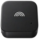
A GeoShake T1 is a dedicated seismometer: bolted to a solid surface, plugged in, always listening. Because it sits still in one quiet place, a single T1 trigger is evidence on its own — the map can say an earthquake reached it, and say when to within a fraction of a second.
A phone that already has the sensor
A community phone is the accelerometer inside a phone you already own, listening while it charges and stopping when you unplug it. Alone it proves little: a phone reports shaking several times a day just from being picked up. But there can be thousands of them, and they sit exactly where people live.
Why put the two together
This is what hybrid network means here. Stations give precision; phones give reach. A handful of instruments can tell you an earthquake happened and exactly when it arrived, but not how far the shaking spread. A crowd of ordinary sensors can outline the felt area across a whole region, yet no single one of them can be trusted to say so. Each covers the other's blind spot.
Early warning is a race, and distance is the whole race
Shaking spreads at three to six kilometres a second. A warning exists only if an instrument near the epicentre felt it first and the message outran the wave — so every second of warning is bought with proximity. No system anywhere guarantees one. Alerts arrive late, or not at all; even the networks running on billions of phones have missed earthquakes that mattered. That is not a scandal, it is the physics: around every epicentre there is a blind zone the warning cannot beat, and the only thing that shrinks it is having a listener closer in.
So the useful question was never will it warn me. It is how close is the nearest listener — and that is a question a network in people's homes can answer better than an array with stations a hundred kilometres apart.
Three is the number that matters
One station knows that something shook it. Two could be a passing truck. It takes three stations within 90 km, agreeing inside fifteen seconds, before the network will call an earthquake itself — and that is the same bar an early warning has to clear, because an alert that might be a lorry is worse than no alert at all. Clear it, and the network knows in seconds what a catalogue takes nine to twenty-four minutes to publish. It is also why a new station is worth most where there is already another one: three instruments near each other are worth more than thirty scattered across a continent.
Different sensors, different rules
Because the evidence is not equal, the map does not treat it as equal. Stations corroborate stations and phones corroborate phones; the two never combine into one detection, because they run on separate detectors and a line between them would promise something the system does not do. A phone's trigger counts only when enough of the phones that should have felt the shaking agree — and only when that rises above the ordinary background rate of the area.
Open, all the way down
The firmware running on every station is open source, and so is the signal-processing code that decides what counts as a trigger — both GPL-3.0. The enclosure is CC BY-SA: print your own. The seismic data is CC BY 4.0, and every station also streams into standard seismological tools. You do not have to take this map on faith. You can read the code that produced these numbers and download the records behind them.
It exists only because people built it
Every marker here is someone who decided to put a sensor in their home. The network has no other source of coverage: where nobody joins, the ground simply goes unwatched — and the blank spaces on this map are not places without earthquakes, only places without listeners. Put the app on a phone, or a station on a wall. Either one moves a blank spot a step closer to a detection.
Latest earthquakes on the map
- M4.6Southern Xinjiang, China2026-09-22 16:09 UTC · 10 km deep · EMSC
- M4.3Off Coast Of Chiapas, Mexico2026-09-22 15:52 UTC · 10 km deep · EMSC
- M4.8Kuril Islands2026-09-22 13:56 UTC · 93 km deep · EMSC
- M4.3Halmahera, Indonesia2026-09-22 12:24 UTC · 224 km deep · EMSC
- M4.1Off Coast Of Chiapas, Mexico2026-09-22 11:53 UTC · 10 km deep · EMSC
- M4.77 km WNW of La Gomera, Guatemala2026-09-22 11:43 UTC · 89 km deep · USGS
- M4.4121 km E of Miyako, Japan2026-09-22 11:37 UTC · 26 km deep · USGS
- M4.438 km S of Jurm, Afghanistan2026-09-22 11:29 UTC · 193 km deep · USGS
- M5.188 km NNW of Uken, Japan2026-09-22 10:46 UTC · 10 km deep · USGS
- M4.6296 km S of Ambon, Indonesia2026-09-22 10:30 UTC · 296 km deep · USGS
Catalog entries from USGS, EMSC, AFAD and GeoNet at the moment this page loaded; the map and the list on the left keep updating live. Open data and the API are on the Developers page.
No stations found